Bearing Determination
Created by System on 21 Feb 2013 @ 9:30pm
Navigation:
Navigation consists of a series of mathematical equations which calculates the relative distance between a point of origin and destination.
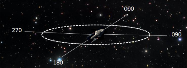
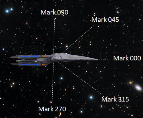
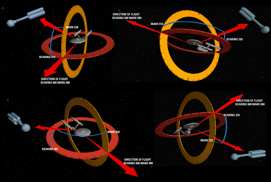
Plotting the relative course of a space vessel begins by identifying a destination relative to the point of origin (the vessel itself). There are two axis to consider - a 360 horizontal "compass rose" encircling the space vessel, and a 180 degree vertical axis, known as the "mark axis".


Once a destination has been identified relative to a space vessel, the vessel is orientated on a "course heading" to place the vessel directly aimed at the destination. At this point, the vessel is said to be "on course" and engages its engines. En route to the vessel's destination, minor course corrections are automatically plotted to take into account gravity phenomena, stellar drift, and effects of time dilation at warp.
Bearing:
There will be many time were it is necessary to designate the location of objects near a vessel. The means of doing this is similar to plotting a course. You designate the objects location by calling out the number of degrees on the horizontal axis, "mark" the number of degrees on the vertical axis. The intersection of these two points, plus distance, gives you the location of any nearby object.

Categories: Phoenix Information